New Standards – Not Congressional Meddling – Are Needed to Address Rising Risk of Floods
By Rob Moore, Natural Resources Defense Council
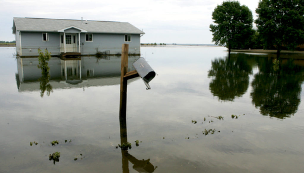
FEMA flood maps and estimates of flood levels determined by the U.S. Army Corps of Engineers (Corps of Engineers) severely underestimate the true risk of flooding on Midwestern rivers, according to a new study by Washington University in St. Louis researcher Robert Criss.
The report’s findings underscore the importance of a new federal flood protection standard announced by President Obama in an executive order signed earlier this year. Under the order, federal agencies would be required to include an additional safety factor to account for uncertainties in current and future flood risk — a safety factor the new study shows is desperately needed.
The old standard, which had been in effect since the 1970s, required federal agencies to use the elevation of the 100-year flood as a way to determine where to safely build federally funded buildings and infrastructure projects. But as the new study shows, FEMA and the Corps may be underestimating this elevation flood by 1-1.9 meters, or 3.3-6.2 feet on Midwestern Rivers. This means the 100-year flood is actually far more frequent and far more likely to occur than FEMA maps and Corps projections indicate. You can read more about the study at ClimateWire.
The new standard, meanwhile, requires federal agencies to build to a much safer, smarter level, using one of three benchmarks:
- The elevation of the 100-year flood (a 100-year flood has a 1-percent chance of occurring in any given year), plus a projection of how much higher flood elevations may rise due to climate change;
- The 100-year flood level plus 2 feet of elevation for standard projects, and 3 feet of elevation for critical projects like hospitals, treatment plants, etc.; or
- The 500-year flood level (a flood with a 0.2-percent chance of occurring in any given year).
In light of the latest research on flood risks, the administration’s actions are the right thing to do. They avoid costly damages and rebuilding efforts in the wake of a flood, and they also discourage federal spending on projects that might lead to fiscally imprudent and dangerous development of floodplains.
NRDC examined FEMA’s post disaster grants to state and local governments and found that $48.6 billion in federal assistance has gone to repair public facilities in the wake of flooding and hurricanes (see table below for a list of top recipients by state). Not building to a more protective standard comes at a high cost, both in terms of dollars and damages.
 That’s why these federal flood standards have garnered support from fiscal conservatives, as well as environmentalists, and floodplain management professionals..
But Congress is trying to prohibit the safer standards from going into effect. Riders have been added to various appropriations bills that would keep federal agencies, including FEMA and the Corps, from doing their job. The Homeland Security Appropriations bill prohibits all agencies from doing any work on implementing the standard.
The findings of the Washington University study are cause for alarm – and evidence that Congress should not be halting implementation of the new flood protection standard.
The fact is, flood maps made by FEMA and flood elevations determined by the Corps of Engineers are heavily relied upon by federal, state, and local government agencies. Agencies apply these flood metrics – now determined to be way off the mark – for everything from designing levees, water treatment plants, and bridges to siting housing, schools, hospitals and land-use planning. Allowing Congress to play politics with our risk of flooding increases potential for damage and makes us much more vulnerable to future floods.
Compounding the problem, if we’re already underestimating the current risk of flooding, then we are even less prepared for a future where floods are more likely due to sea level rise, extreme precipitation, and other impacts of climate change. A flooding study published this month in Nature Climate Change by researchers from University of Iowa found that Midwestern floods are already more frequent. A study of how climate will affect flood risk commissioned by FEMA found that parts of the Midwest could see the 100-year floodplains increase in size by up to 90%.
It’s essential for FEMA and the Corps to improve their projections of current and future flood risk. Even more importantly, these research findings show why it is critically important that if we want to avoid costly and dangerous flood damages, we factor this increased risk into our decisions about where to build and what to build.
Here’s a closer look at specific actions we should we should take, right now, to account for the rising risk of flooding and other natural disasters whose severity and frequency are impacted by climate change:
- Implement President Obama’s updated flood protection standard. The Federal Flood Risk Management Standard ensures federal agencies build bridges, schools, and water and wastewater treatment plants to better withstand flooding and storm surges from hurricanes. Unfortunately, members of Congress are trying to prohibit federal agencies from implementing this much-needed reform, despite the long-term costs it would impose upon taxpayers.
- Make it easier for people to relocate to higher ground. NRDC has developed a proposal for reforming the National Flood Insurance Program that would make insurance more affordable for low- and middle-income property owners, while also guaranteeing them assistance to relocate after suffering major flood damage.
- Increase the resilience of our drinking water, wastewater, and stormwater systems. Treatment plants are all too often built in floodplains. Stormwater systems are usually not designed with future extreme rainfall events in mind. NRDC wants to see states make better use of funding they already have to make the nation’s water infrastructure better prepared for the impacts of climate change.
- Better assess the risks of extreme precipitation due to climate change. At NRDC’s urging, FEMA recently decided to require states to include an assessment of climate risks when developing disaster preparedness plans, also known as Hazard Mitigation Plans. These plans are important sources of information about community vulnerability and are used to prioritize how best to mitigate risks from future extreme storms and flooding.

